Ferrol military batteries (A Coruña)
A scientific journey through its defensive history
Destinos Observer®


Temáticas científicas
 Historia
 Medio Marino
 Arquitectura
 Ingeniería
 Medio Ambiente
 Ornitología
 Historia industrial
¿Por qué es interesante este Destino?
Why is this Destination interesting?
Galicia has been, since ancient times, the dream of expansion of many peoples: Celts, Romans or Swabians. The Vikings arrived on its shores in the 10th century and they were followed by the English and French. Its ports became strategic enclaves for the defense of the territory, but also for the international aspirations of what is now Spain.
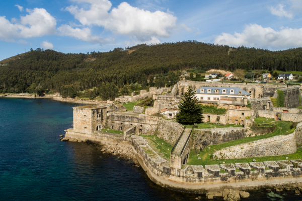
The history of the Ferrol military batteries begins, then, even before they were projected. The conditions of the estuary, with a large opening in its mouth and a narrow central body that reopens inside into a large belly, led it to be designated by the military engineer Tiburcio Espannocchi as “one of the safest and most capable ”of welcoming the royal ships on their way north. Felipe II, whom Espannocchi served, designates Ferrol as the port of his Navy and with it begins the true development of the city, which will lead to the construction of great emblems such as the Arsenal and the A Graña Shipyard, already with Felipe V.
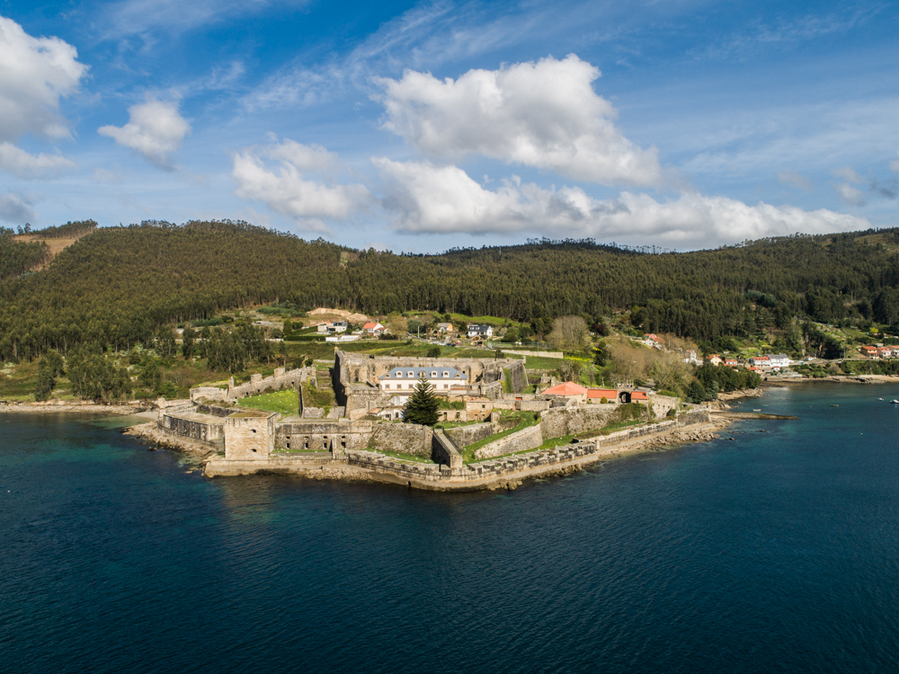
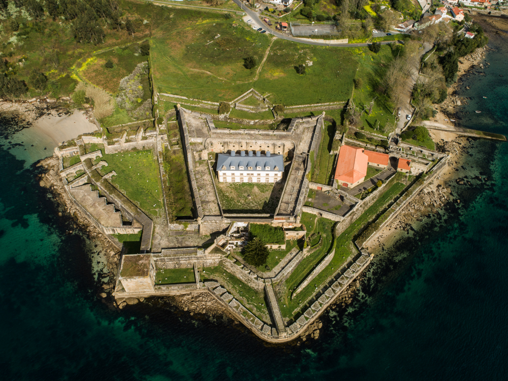
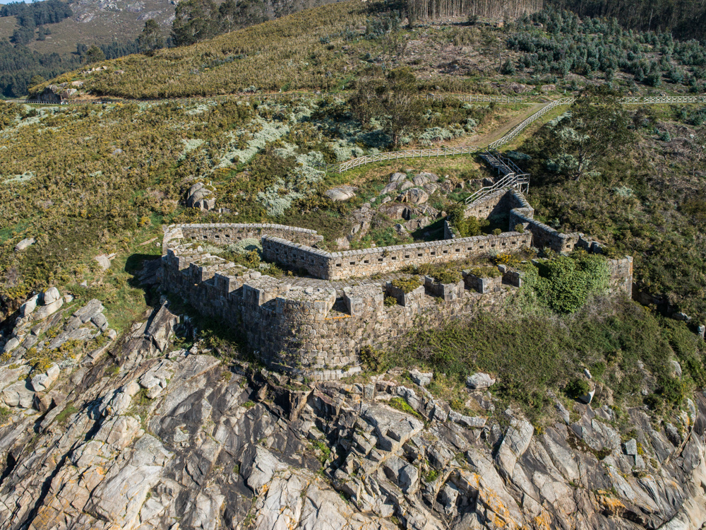
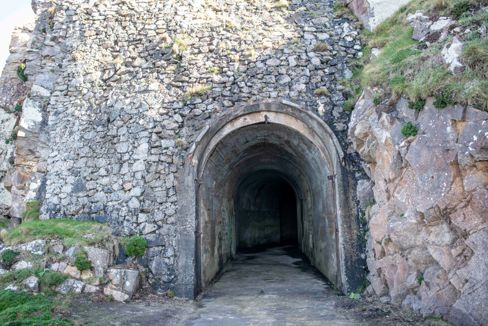
It was necessary to protect this delicate shelter, so Felipe II ordered the construction of a fortress that would bear his name at the end of the 16th century, right in the belt of the Ferrol estuary. The castle of San Felipe, accompanied by that of Palma and San Martín on the other side of the estuary, formed the first defensive trident in the area. With their crossfire they could attack enemy ships as soon as they entered the narrow estuary.
Para saber más sobre este Destino pulsa aquí...
Imágenes


Vídeos
Rutas
 Historia defensiva
Puntos de interés del destino
 Century XVI
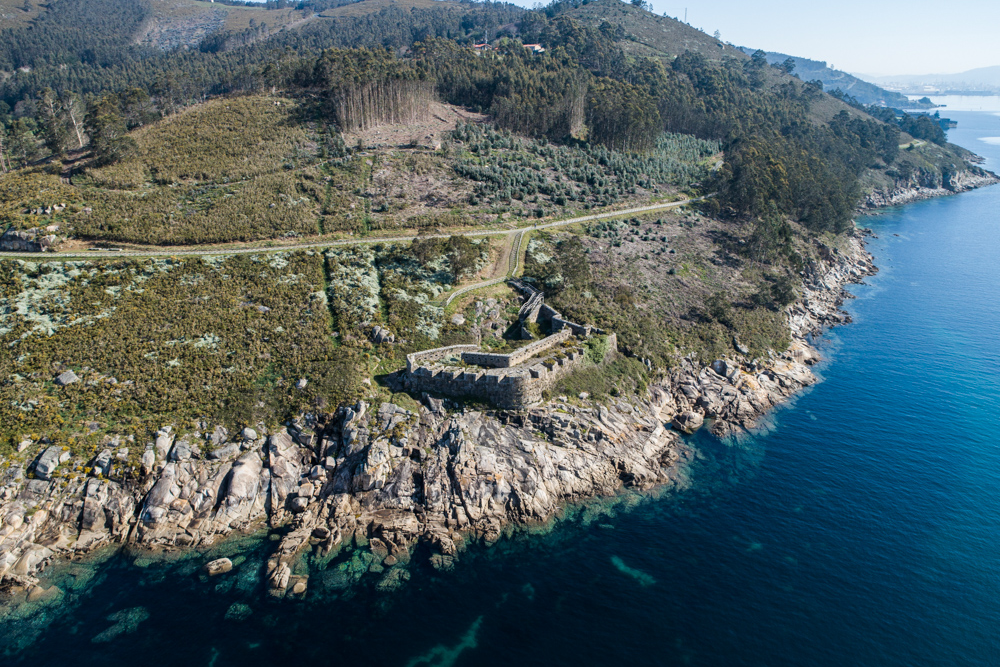 8th century
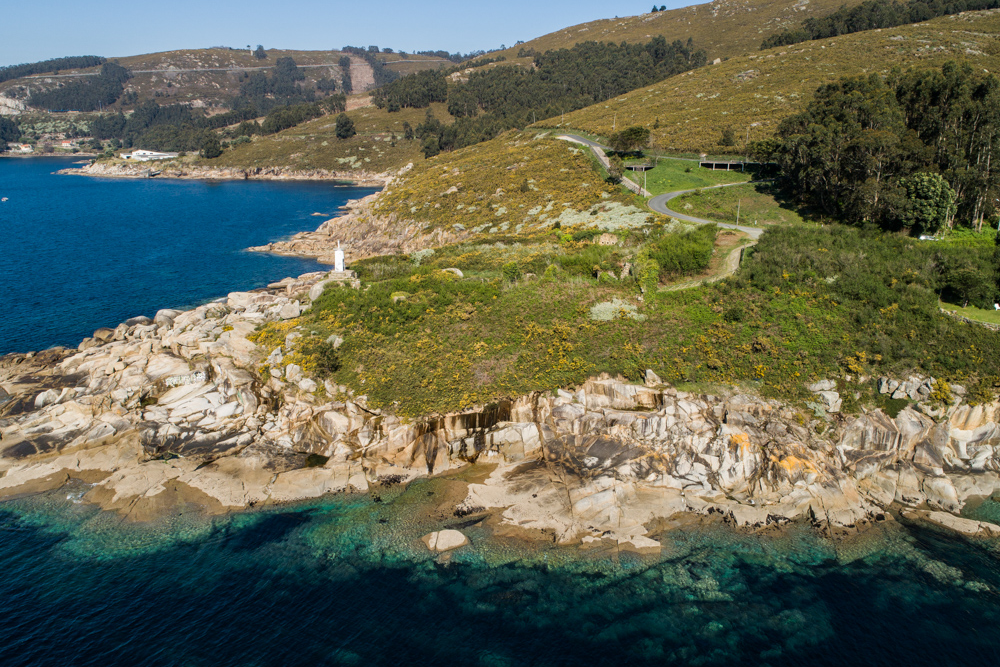 Century XVIII
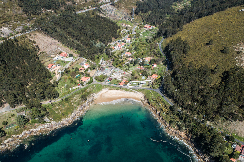 Mediados del S. XVIII
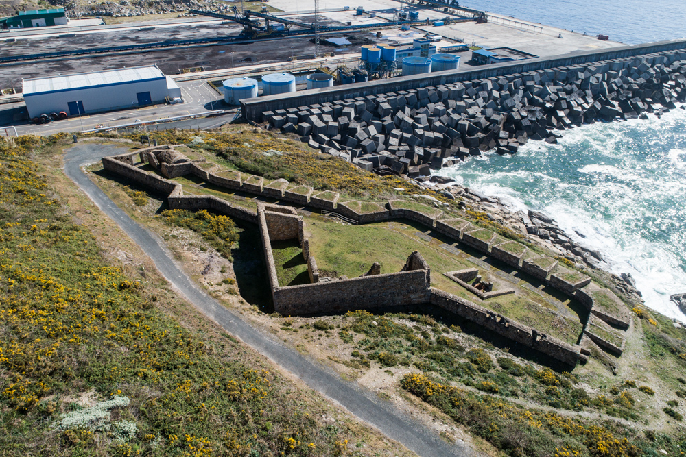 Siglo XVIII
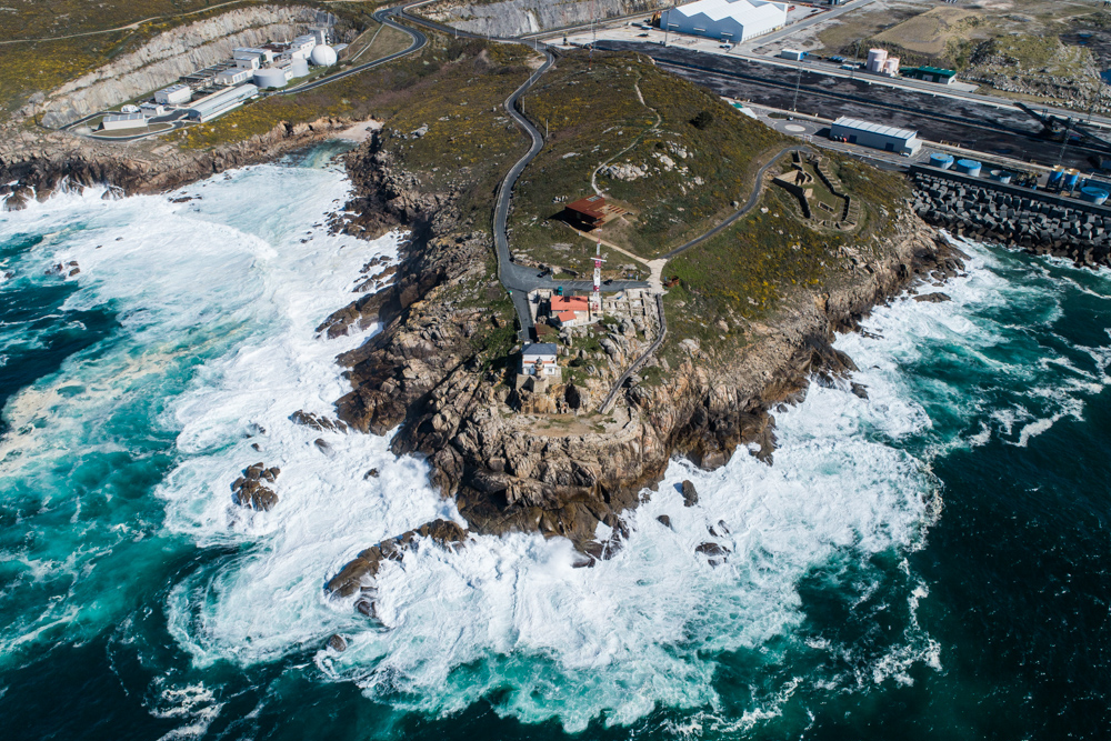 Siglo XX
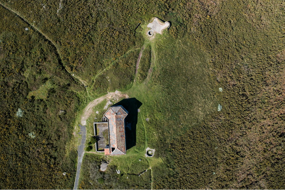 Siglo XX
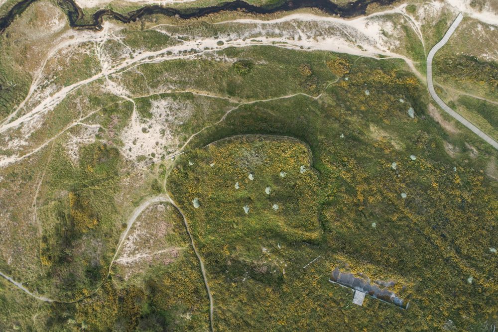 Siglo XVIII
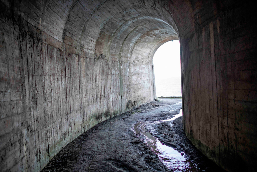 Siglo XX
Información al viajero
 Tren
Tren Barco
Barco Transporte público
 Coche
Coche
 Hoteles
 Casas Rurales
 Restaurantes
 APP de rutas
 Punto de información general a visitantes
 Itinerarios científicos
 Guías y catálogos
 Sinaléctica
 Empresas de actividades
 Especies protegidas
 Proyectos I+D+i
 Seguimiento de los valores naturales
 Público general
 Grupos organizados
 Centros educativos
 Investigadores científicos
 Ciencia Ciudadana
 Fotografía científica
 Avistamiento de aves
 Observación de estrellas
 Rutas etnográficas
 Rutas geológicas
 Recorrido espeleológico
Para saber más
To Know more
The irregularity of the Galician coast is due to the presence of the estuaries, bays that are longer than they are wide, which are an extension of a river and through which an arm of the sea enters, either for geological reasons or due to the rise in level of the water. In the estuaries, the fresh water from the rivers converges with the salty water from the sea, and this mixture is known as brackish water.
Specifically, that of Ferrol, is a type of estuary known as a funnel, because it corresponds to the lower part of a river flooded by the sea. In this case, the formation of the estuary is mainly due to the erosion produced by the Xubia River, while in other cases, the main factors are tectonic movements. This estuary was formed during the Neogene, a period that began 23 million years ago and lasted until 2.59 million years ago.
Organize your visit well
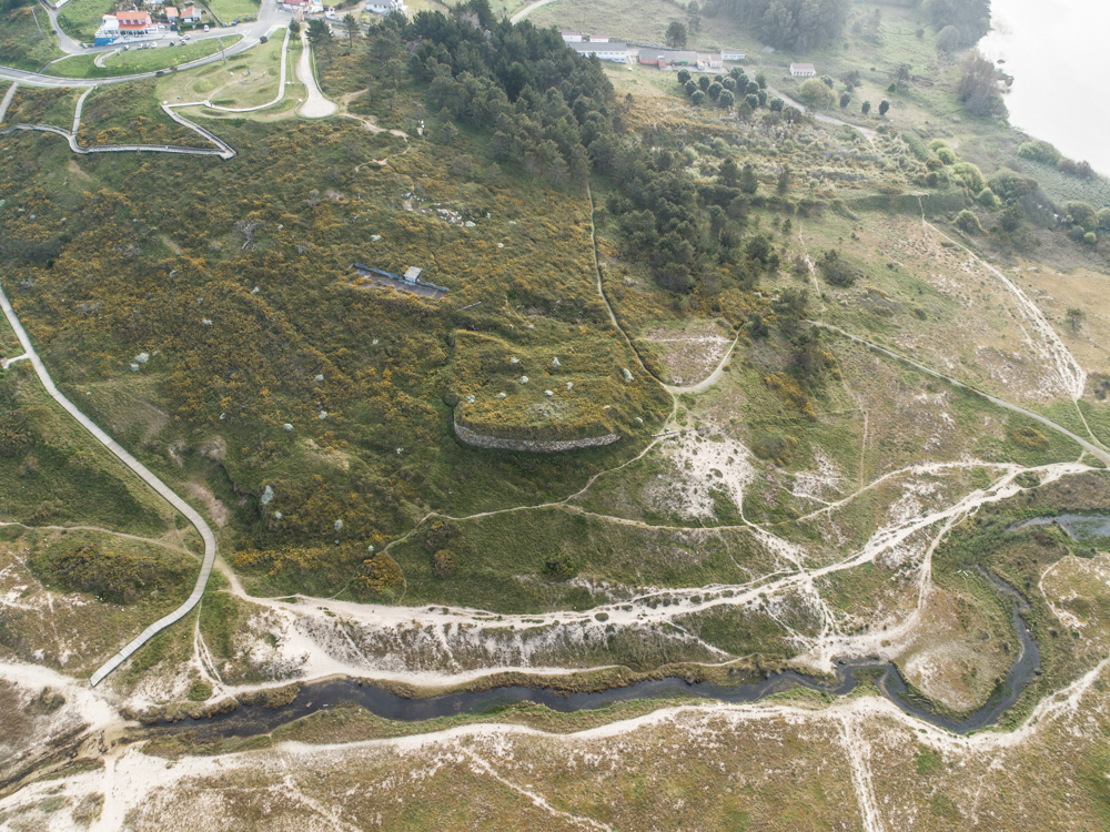
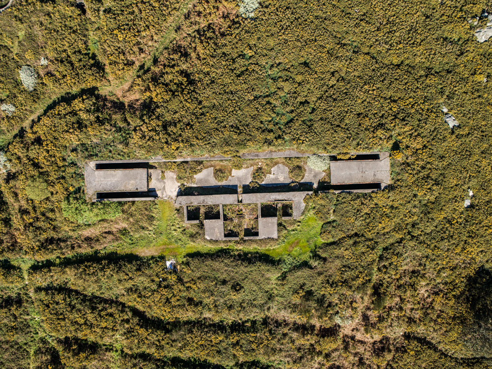
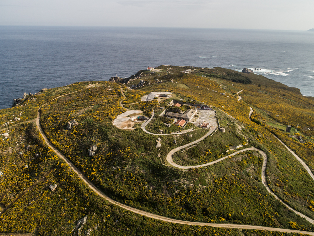
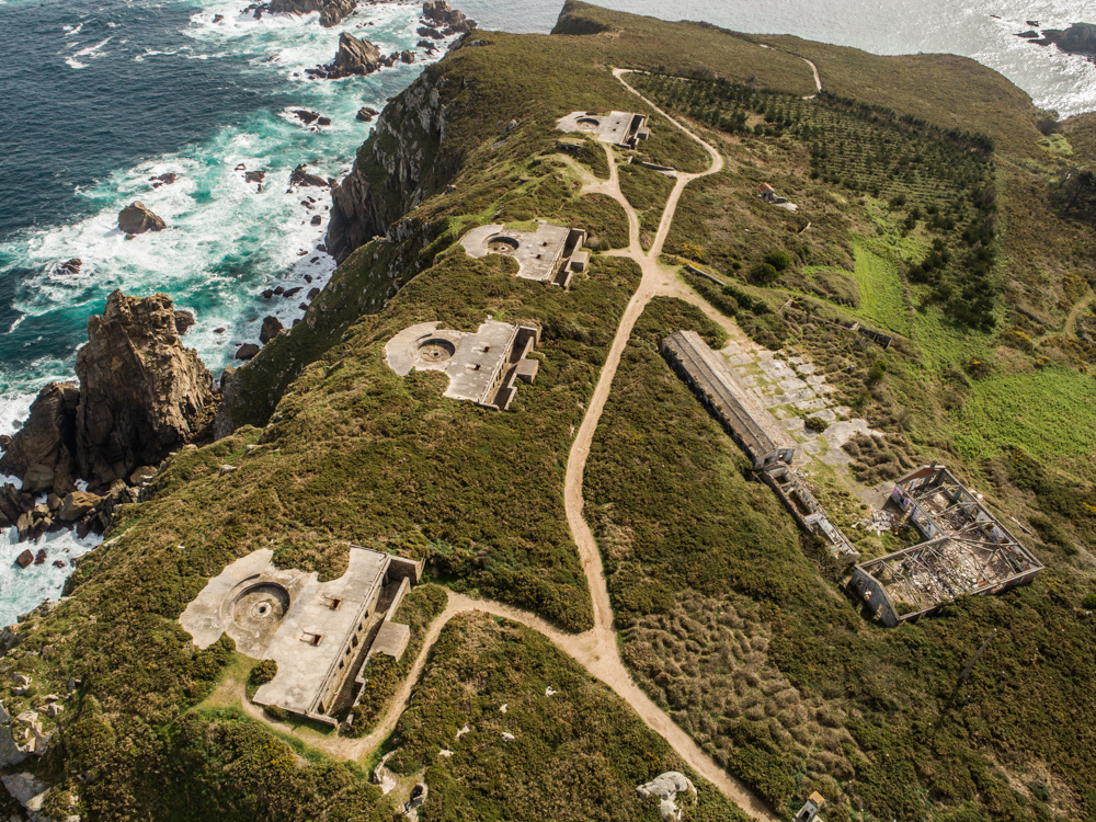
Although on the map the arrangement of the batteries seems to occupy a very affordable space for a day, appearances are deceptive. The route by car from the castle of San Felipe, the closest defense to the city of Ferrol, to Cape Prior, the furthest point, passing through all the batteries, consists of about 30 kilometers. To this must be added the stopping times at each point of interest, as well as the fact that in some of them it is necessary to take a good walk to discover its entirety. In order to explore all the batteries and not end up exhausted, the recommended time is two days.
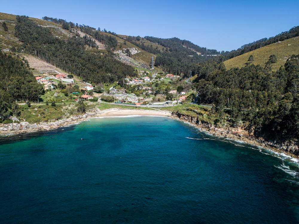
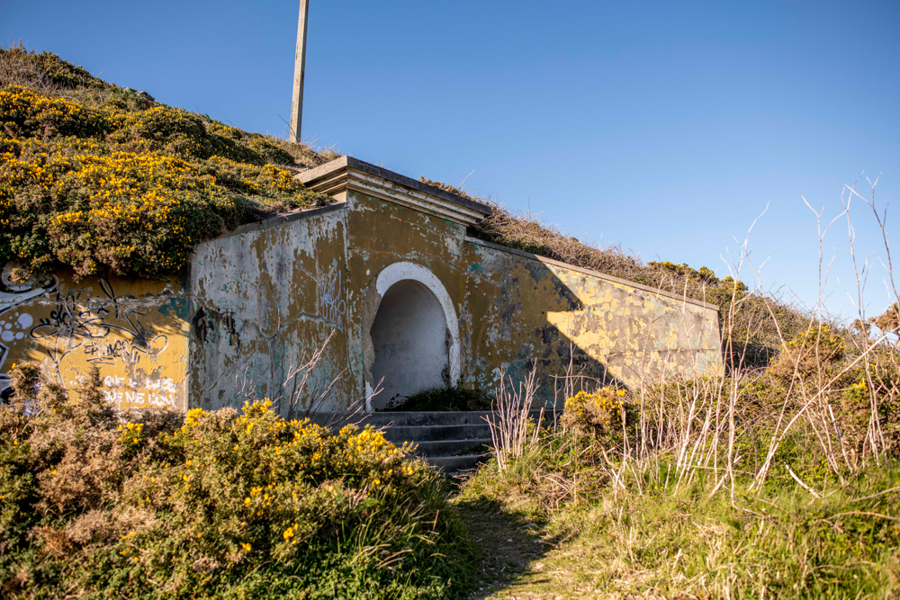
The castle of San Felipe requires at least an hour to explore its walls and history. In its surroundings you can also enjoy a cove of the same name, just 500 meters away. The castle is integrated into a small urban center with restaurants, which allows you to buy something last minute or even eat.
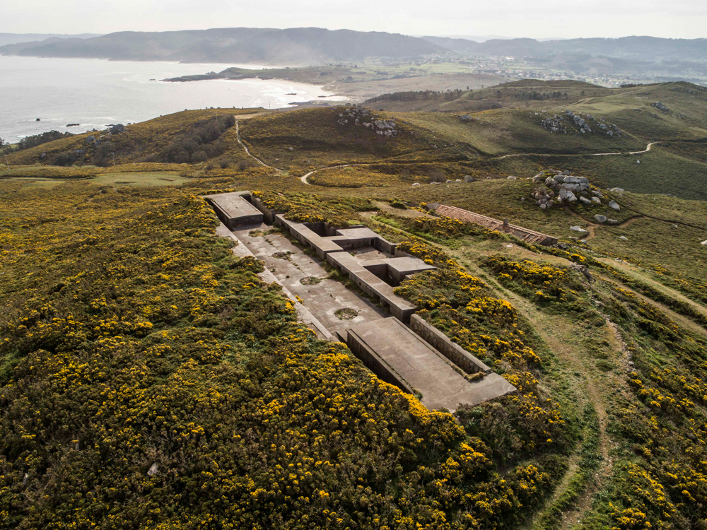
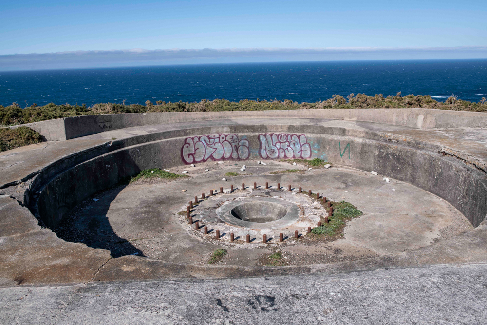
The same does not happen with the following batteries, those of the Cariño cove, all of them are in a completely natural setting, only dotted with some private homes.
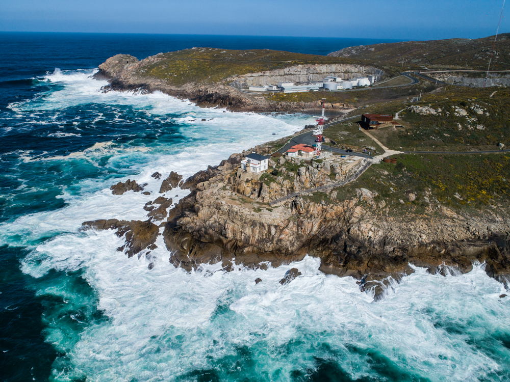
If you decide to do the route of the castles, which goes from San Felipe to San Cristovo, or even continue it to Cariño beach, it is recommended to bring, at least, water. They are just over 4 km one way and another 4 back. It is not advisable to complete the route to Punta Viñas on foot if you are not in good shape, since the slope there is very considerable and along the coastal road it would take more than two hours only on the outward journey.
All the batteries can be reached practically by riding in the car, but the best way to get to know them is by walking among their ruins and exploring the territory, since a good part of them remains hidden (especially in Prior and Prioriño). That is why it is important to wear comfortable shoes.
Bibliografía asociada
(Solo disponible en idioma español)